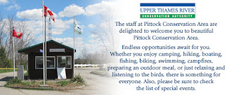
Also: To restore the ability to walk across the Pittock dam from Rivercrest Drive to what is currently a conservation area
By Mark Schadenberg
Chair
Woodstock Recreation Advisory Committee
A look into Woodstock's future is all
about planning now for the cityscape of 2030.
With the 401 on the south and east
perimeter wrapping around the Friendly City, growth will certainly
continue north, and that will continue the on-going expansion of the
Senator Homes subdivision on the north shore of Pittock Lake (a widening of the Thames River).
If you're older that 55 and grew up in
Woodstock, (I'm a mere youngster of 49) you would remember a time when the Gordon Pittock
Reservoir didn't even exist along the route of the Thames River.
The Upper Thames River Conservation
Authority was established in 1947. Pittock Lake was created as a
method of controlling water flow and eliminating possible future
floods, and it was officially opened in 1967 at a cost of then-dollars of about $6 million. Gordon Pittock, by the way, was
Oxford's MPP in the Conservative government of John Robarts from
1963-67. Pittock was an original UTRCA member, was from Ingersoll,
and passed away in 1983.
CENTRAL PARK
Is it possible that in the future,
Pittock Lake and its two current parks – Pittock Conservation Area
(campground) on the north side and Roth Park on the south banks – will be Woodstock's
central park.
The City of Woodstock staff from the
parks and recreation department is currently drawing up plans and
will seek public opinion and council approval to assume control of
what is today considered the day-use park at the Pittock campground,
which includes washroom facilities, a beach volleyball court, kids'
play equipment and a large grass-covered parking lot. The UTRCA owns
the land and manages it due to its importance of the Thames
watershed.
()()()()()()()()()()()
IMPORTANT NOTE: This story is not new news as the previous city council had already been discussing these options about expanding municipal parks and creating this new space as active and open parks for citizens to actually use and enjoy.
The news is the public meeting scheduled for Oct. 7.
()()()()()()()()()()()
However, Brian Connors at city hall and
Chris Kern from the parks department, along with many others are
sitting on one side of a triangle table with topographical maps
endeavouring to a write a game plan for the near future and that
encompasses acquiring lands currently not considered municipal parks. Many previous studies have led up to today, including a county trails master plan, a master plan for Burgess Park along the Thames, and recreational facility needs report.
On the proposal table for example, is the actual dam could be transformed back into a walkway
so cyclists, hikers and strollers could access both sides of Pittock.
That trail loop would extend the extensive paths through meandering
path of the Thames River to extend beyond County Road 4 (and
obviously include The Pines cycling trails east of Oxford Road 4) and
then along the Thames to Highway 2 at the train bridge at Dundas
Street.
When you factor in the current
Millennium Trail on the south side of Dundas at that same location,
and place consideration on the dirt-moving sweat equity efforts of
the Oxford County trails council, the trail loop will (could) extend
to Beachville.
To make all these dreams reality,
citizens are requested to attend a public meeting on Oct. 7 at the
community complex. The open house format meeting will be in the
meeting room directly across from the gymnastics facility at the
WDCC.
The current park space within the
Pittock Conservation day use area, which visitors must now pay to
utilize, will be free space with trails across the Pittock dam. Free
is important and misleading as there will be a tax burden for citizens – yet to be
fully calculated – but, everyone from sailors to fishing boats will
gain a free boat launch area.
The current pay-to-use campground will
continue to exist as would the sailing club.
The project's focus is also more
extensive that I describe as it includes the City acquiring control
over two more parcels of land to extend the trek completely around
Pittock on both banks. I use the word 'bank' intentionally, as there
will be costs associated with purchasing tracts of currently open
green space (forests and unkept thicket) property, building trails
and then maintaining this new recreational space. Within the next 10
years, Woodstock could more than double its current trail system from
about 10 kilometres is 22, and add about 90 acres of parkland to be
dedicated as permanent recreational green space.
This will be great
for the present (now, today) and a present (gift pun) for future
generations.
Currently – it must be pointed out –
the Harry Roth Park south park at Pittock, which is essentially found
at the end of Huron Street, is currently maintained through a
cooperative contract between the UTRCA and the Woodstock parks
department.
Exciting times for recreational needs in Woodstock as our community negotiates an 'understanding' with the UTRCA and looks forward to 2030.
LINKS:
http://www.woodstocksentinelreview.com/2014/09/22/woodstock-looking-to-ink-agreement-with-upper-thames-river-conservation-authority-to-extend-trail-system
I've been a member of the Woodstock Recreation Advisory Committee for 14 years, and chair for the past 4
Mark
Schadenberg, Sales
Representative
Senior
Real Estate Specialist (SRES designation)
Royal
LePage Triland
Realty
Brokerage
757
Dundas St, Woodstock
(519)
537-1553, cell or text
Email:
mschadenberg@rogers.com
Twitter:
markroyallepage
Facebook:
Mark Schadenberg, Royal LePage Triland
Discussion
. . . Direction . . . Determination . . . Destination


No comments:
Post a Comment